
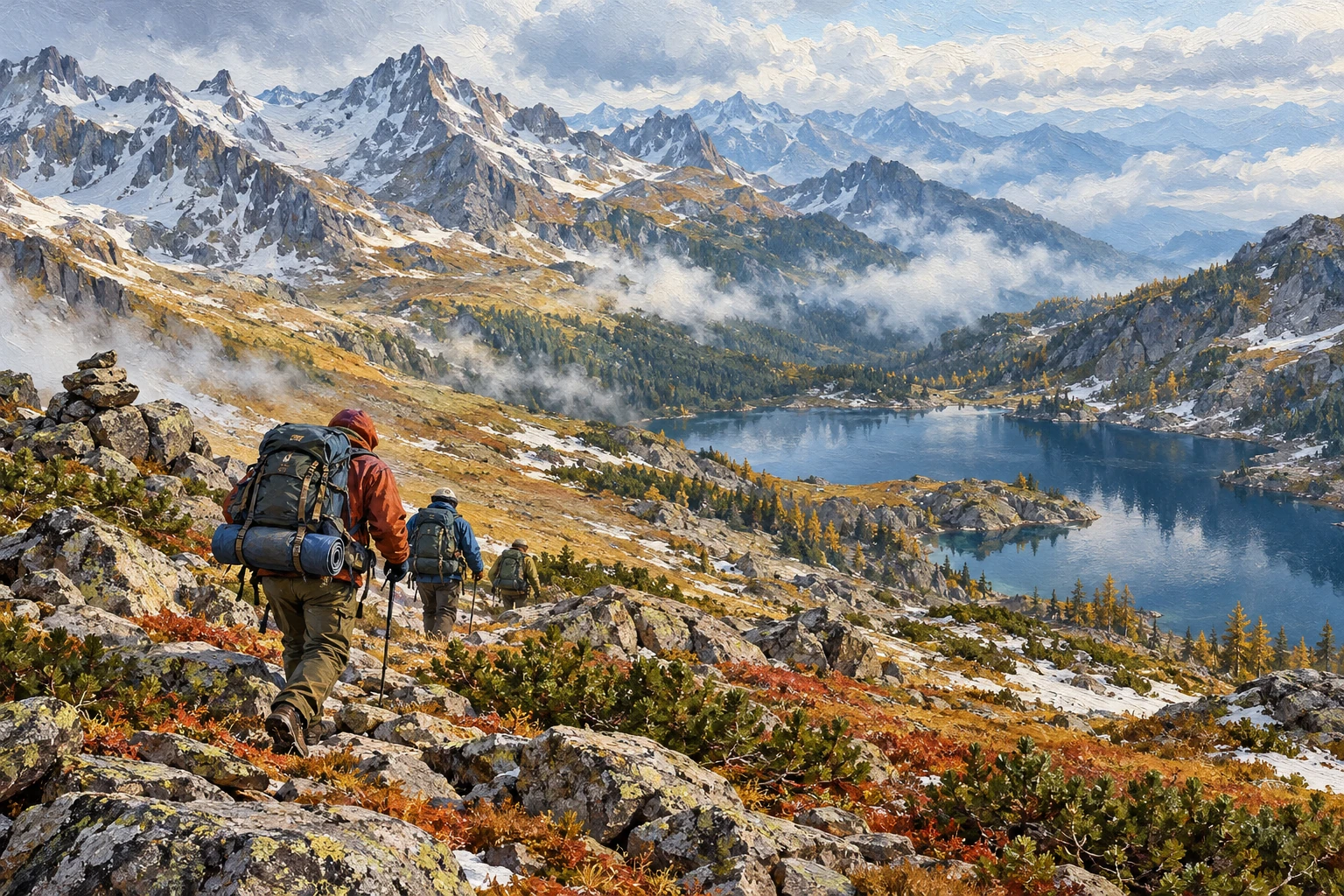
“Happy is he who knows the aching feeling of the road…” (“People Walk Through the World”) Pos. Barguzin — b. Nesterikha — Mechta pass — lake. Ladokhinskoe — r.
Malaya Cheremshana — village. Chivyrkui — Zmeinaya Bay (min. source) — village. Glinka (non-residential) — village. Ust-Barguzin.
The length of the route is 170 kilometers, duration is 12–14 days…. One winter evening at the city tourist club “Hamar-Daban”, where, out of habit, we met every Wednesday, leafing through old folders with the head of the search and rescue service of Buryatia, Yuri Golius, a familiar telegram caught our eye. It reported: “The route point Nevsky is ready for the assault on the Barguzinsky ridge.” These words reminded me of many things.
Barguzinsky ridge… It is unlikely that anywhere else you can find such a variety of natural landscapes in a small space! It will not be an exaggeration that the Barguzinsky Range occupies a special… perhaps an exceptional place in terms of the variety of opportunities for tourists. Here you can alternate rock crossings that require the use of special equipment with rafting on mountain rivers, exhausting passes over high ridges with calm walks along sandy beaches under the roar of Baikal waves.
Next to the dunes, reminiscent of the landscape of great deserts, there is a tundra, and higher up in the mountains, forests gradually give way to the most beautiful subalpine meadows, even higher — only pointed peaks. All these pictures, replacing each other with lightning speed, flashed through my memory. But to talk about this, you will need to write a lot of pages… Having conceived a trip, bit by bit you collect the necessary information about the travel area.
Just as on photographic paper, when it is developed, the outlines of the photograph gradually appear, so in your mind the image of the future route emerges more and more clearly. Vague at first, but every detail complements it, makes it more detailed. And here is the finished picture: you outline crossings and passes, mentally overcome untraveled paths, shade out the white spots… you are a pioneer! It’s not often these days that you get to see the world through the eyes of a pioneer.
Sometimes you get into the very wilds, you think that no human foot has ever set foot here before, but you look back — there is an iron tripod of a triangulation sign standing nearby… The topographers not only climbed here themselves, but also dragged the necessary structure and tools. In September 1983, the Buryat Regional Council for Tourism and Excursions, now the well-known Tourist company, organized an expedition to the Barguzin ridge area. I was entrusted with leading the group, which included nine experienced tourists.
A specific task was set: to select, describe and, if possible, make a preliminary marking of a planned pedestrian route linking it to the Maksimikha tourist center. After studying several options, we chose a route crossing the Barguzinsky ridge through the watersheds between the upper reaches of the Nesterikha and Malaya Cheremshana rivers. The route began in the village of Barguzin, where tourists arrive by bus from Ulan-Ude, having covered just over three hundred kilometers along the picturesque Barguzinsky Highway. The village of Barguzin is the center of the Barguzinsky district.
There is a post office, telephone, telegraph, hospital, shops. The newspaper “Barguzinskaya Pravda” is published. The village is also interesting for several historical monuments: the Kuchelbecker brothers served their exile here (unfortunately, the house of the Decembrists has not survived). Until 1924, Barguzin was considered a county town and had its own coat of arms, which depicts the silhouette of a squirrel on a silver field.
This is due to the fact that the best squirrels were caught here. The past and present of this wonderful region are told in the exhibitions of the local museum. At the rural cemetery, tourists will be able to visit the grave of the Decembrist Mikhail Kuchelbecker, and stop in front of a modest obelisk at the grave of the founder of the Barguzinsky Nature Reserve and its first director, Zenon Svatosh. From Barguzin, tourists take a passing car to the village of Nesterikha — the starting point of the walking part of the trip.
The village is no more than eight kilometers along the Barguzinsky tract. The torch path winds along the left bank of the Nesterikha River, gradually gaining altitude. After about five kilometers the river makes a sharp bend. We’re straight and up.
The further path is along an unnamed spring, densely overgrown with currant and honeysuckle bushes. The trail is noticeable and solid. Overnight in the upper reaches of the spring. On the second day of the hike, having reached the upper reaches of the spring, we continue to climb the slope of the valley.
There is no path, fallen trees block the path. At rest stops you can enjoy lingonberries, which are found in abundance. In the middle of the day, after a difficult climb through windbreaks and dense thickets of dwarf cedar, tourists reach the crest of the ridge. It’s much easier to walk here.
The Barguzin Valley is clearly visible from above. On this day, we managed to walk no more than 12 kilometers with heavy backpacks. Overnight on a vast pass saddle, through which in ancient times a horse trail led from the Barguzin Valley to the Baikal shores. Water and firewood are available here in abundance.
On the third day of the hike, the thickets of dwarf cedar will be replaced by rocky placers, turning into mountain tundra. During our journey, the group, in thick fog, reached the highest point on the route, marked 2,178. A tour was set up on a noticeable rock outcrop. Leaving a note in it, we continued our descent to the lake at the source of the Malaya Cheremshana River.
We mainly walk this part of the path along the old path and only before the lake we descend along a solid ridge to the shore. Among the low-growing larches and thickets of elfin wood, we set up our third camp. About 20 kilometers were covered that day. A day and radial trips to the vicinity of Lake Ladokhinskoye are planned for tomorrow…
From the expedition’s travel diary: “September 12, 1983, Monday, the fourth day of the hike. Rise at 09:00. At night it rained, giving way to snow. The sky is completely overcast and it rains periodically.”
Due to bad weather, we canceled the planned day and radial outings. At 11:30, having turned up camp, we go down the river…” The path along the right bank of the Malaya Cheremshana is quite difficult. Pathlessness, dizzying detours of pressures, numerous fords, exhausting transitions along the dwarf forest, descending straight to the water itself.
The journey from the river’s source to its mouth takes two days. You can spend the night in a good winter hut located there, which can accommodate a group of up to 10 people. The winter quarters belong to Ivan Alekseev. Next, our group took the direction to the Malo-Cheremshansky cordon.
There is no clear path from the winter hut, but clear ridges are visible indicating the direction. The transition from the winter hut to the river mouth takes four hours. A boat separated from the opposite bank of the river and headed in our direction. Soon we cordially shook hands with the forester of the Cheremshansky cordon, Mikhail.
Having told about our route and the purpose of the trip, we settled down for the night in a cozy winter hut. The stove was burning hot, a kerosene lamp was glowing in the corner, and fabulous shadows wandered along the walls of the hut. I remember with gratitude the winter huts in which my companions and I found shelter over many years of travel. In the morning, after thanking the hosts, we set out on the route.
The sixth day of the journey has arrived. The next overnight stay was supposed to be on the Kedrovaya River, where there was a spacious fishermen’s hut for this purpose. From the cordon we left along the shore of Lake Baikal. After the taiga wilderness, the vast expanse is somehow perceived in a special way.
Approaching the place where the coastal cliffs plunge steeply into the water, we climb an inconspicuous path along the Medvezhiy stream into the mountains. The trail soon becomes completely lost, and we find ourselves under the canopy of the dense wilderness of Podlemorye. Movement is hampered by dense vegetation and fallen trees. In one place we ventured down to the shore and tried to walk on the rocks, but soon we had to climb the steep slopes again.
At the end of the day we descended into the wide valley of the Kedrovaya River, completely filled with powerful cedar trees. Having walked about two more kilometers, we saw a log hut on the shore of a miniature bay. The hut can accommodate 20 people, there are bunks and a stove, which creates comfortable conditions for spending the night. During the whole day we hardly covered more than eight kilometers.
The eighth day of the journey is the transition from the river. Kedrovaya to the village of Chivyrkui, a length of about 18 kilometers. The shores here are rocky, dropping steeply into the water in the form of sheer walls and cliffs. Small rivers and streams flowing into Baikal cut through the walls of coastal cliffs, forming deep canyons.
There is no trail along almost the entire length of this section of the route. In general, the trek is very difficult and the participants of the trek need to be in good physical condition. The trail appears after the Sukhoi River, a few kilometers before the village of Chivyrkui. The path, laid at the very edge of the coastal cliffs, is very picturesque.
It elastically twists around huge boulders, dives into thickets of dwarf cedar, and crosses bergenia plantations. From here you can see a panorama of the Chivyrkuisky Bay, one of the most enchanting corners of Lake Baikal. Its picturesque islands, steep rocky bays and warm waters leave a lasting impression. All this makes Chivyrkuisky Bay an extremely attractive place for recreation.
It was not by chance that the route of our expedition ran right here, so that tourists would soon follow this Baikal trail. The village of Chivyrkui appears unexpectedly. We descend sharply straight to the forest guard cordon. This is a large, strong house in two halves, built at the beginning of the last century.
The next day we got acquainted with the village and its surroundings, and examined the fish breeding workshop. Giving explanations, the head of the workshop A. Kartashev said that the equipment of the workshop allows for the laying of 280 million omul eggs. On the same day, we set off on the passing boat “Verny” to Zmeinaya Bay.
Zmeinaya Bay is located in the depths of the vast Krestovaya Bay. There is a hot mineral spring here, which is a natural monument of republican significance. It was here, in Krestovaya Bay and neighboring Ongokonskaya and Fertik, that the events so masterfully described by the original Buryat writer Mikhail Zhigzhitov in the trilogy “Podlemorye” took place. Let’s take, for example, this passage from the book: “In Krestovaya Bay, next to the rocky Kurbuliksky Cape, a river flows into Baikal.”
She is good-natured and cheerful, but, wow, no one thought of giving her a name. And suddenly, on its sandy shore, at the very mouth, old Marshalov knocked down a lopsided shack and began to live in it. Oh, once upon a time there lived a river that began to gurgle even more merrily — it had its owner. And since then, people began to call that silver river by a loud name — Marshalova or Marshalikha.”
Rounding Cape Kurbuliksky, take a closer look at the sandy shore, and in your imagination you will certainly see for a moment the lopsided hut of an eccentric old fisherman and he himself — the owner of the silver river. This is the most visited place: planned tourists from the Maksimikha tourist center, numerous groups of amateur tourists, as well as local fishermen come here. For this reason, the condition of the mineral spring, which is catastrophically cluttered and is often used as a laundry, is of great concern. Relict snakes — snakes that lived near the source — have almost disappeared.
The traditional continuation of the route is from Zmeinaya Bay to the working village of Ust-Barguzin. Moreover, it is more advisable to do the first part of the journey from Zmeinaya Bay to the village of Kurbulik on a passing boat or fishing motor boat. In the village of Kurbulik there is a post office and a store where in the good old days you could buy essential products. From Kurbulik, along a rough path, tourists head past the Sorozhya and Okunevaya bays and soon descend to the village of Monakhovo.
From here, without climbing the mountains or entering the lowlands of the isthmus, the group arrives in a few hours at the abandoned fishing village of Glinka. Here, in a cozy clearing on the shore of the Barguzin Bay, the last night will be spent. But if time permits, you can take a day and devote the second day to climbing the mountain plateau of the Holy Nose Peninsula. The impressions from this one-day hike will remain in your memory for many years.
It should be noted that Chivyrkuisky Bay and the Svyatoy Nos Peninsula are now part of the Transbaikal National Park. At one time, the Lengiprogor Institute developed a project for the Chivyrkuisky National Park. In this project, now abandoned, the Glinka farm was given the place of the central base. It envisaged the construction of a bus station, an aerial chairlift to transport tourists to the Holy Nose plateau, a scientific center, a national park museum, piers, an aquarium at the bottom of Lake Baikal and a number of other interesting objects.
But it is unknown when this project will be implemented. The last pedestrian crossing is about 28 kilometers long — from the Glinka farm to the village of Ust-Barguzin along the shore of the Barguzin Bay. The shore of the bay almost the entire way is an excellent beach of the purest lake sand and only occasionally gravel and pebbles are found, and so on until the very mouth of the Barguzin River. The village of Ust-Barguzin is located on the left bank of the river.
There is a ferry across the Barguzin River. Ust-Barguzin is a large working village in which a river port, a timber industry enterprise, and other industrial enterprises and organizations are located. Communication with the city of Ulan-Ude is carried out by road transport.
@nevsky_alexander
On Instagram: Dubai beyond the postcard — family, the city, discoveries and life between projects. On Threads: thinking out loud about design and AI. On YouTube: videos that need more room than a story. Follow me wherever you feel at home, and let’s keep in touch