
Every time I return from a trip, I bring stones with me. Then you look at them and again experience the exciting feeling of the road. This green stone with silvery layers is chrysotile-asbestos from Mount Nogon-Ula in the Kitoi Mountains, a bright yellow piece of sulfur was picked up on the slope of an extinct Mendeleev volcano when visiting the Kuril Islands, a weighty heavy mineral is copper-nickel ore from the polar mine “Medvezhy”, which is near Norilsk.
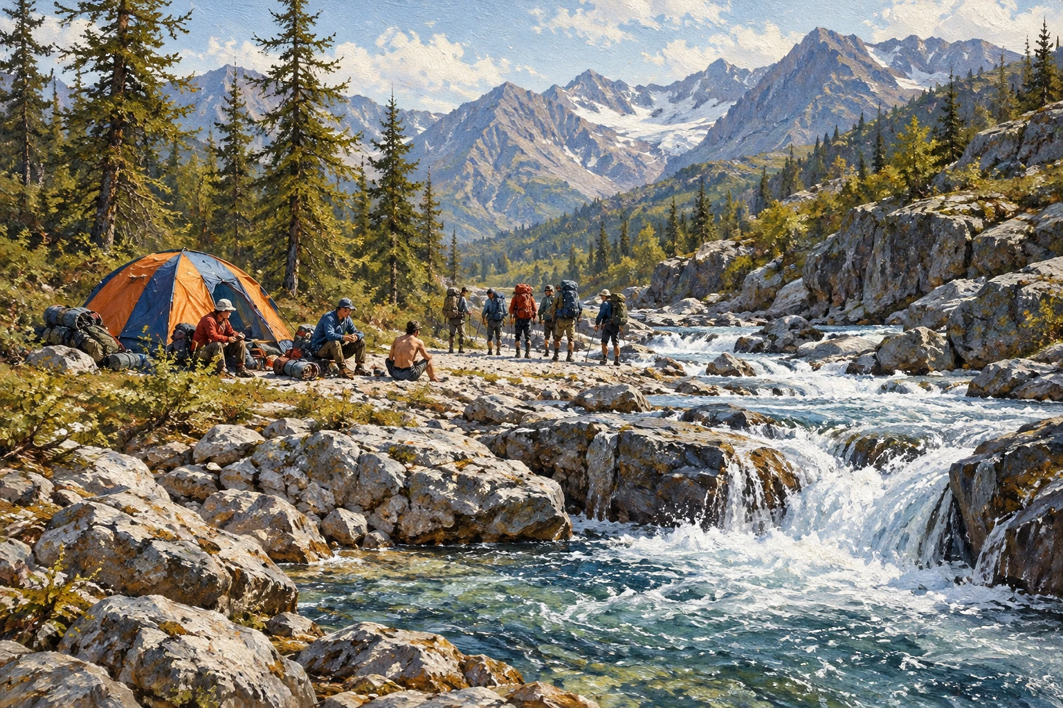
Where does this green stone, slippery to the touch, come from? A difficult mountain route and a clear river with the lyrical name Sagan-Sair, which translated means “white pebbles,” came to mind. Sagan-Sair is one of the major tributaries of Kitoy. Its valley was plowed by a glacier and overgrown with larch and dwarf cedar.
The rocky outcrops and peaks of the surrounding mountains are especially beautiful here. At the source of the river there is a beautiful mountain lake, compressed by scree, behind which is the path to the pass. The pass amazed us with an abundance of sunshine. Inconspicuous flowers huddled against the gray boulders, and wild onions bristled.
Serene peace was felt on this August morning in the surrounding silence of the mountains. Somehow the words from the note left by the Sverdlovsk residents at the pass did not immediately sink in: “15:00, low clouds, snow, occasional sunshine.” And this is in August. The Sverdlovsk residents passed here a week earlier.
I couldn’t help but think: how uncomfortable they were under the cold gray sky, in the whirlwind of snow. From the source to the mouth of the river — one day’s journey. About halfway we came across a small canyon with a river flowing through it. The canyon ended with a beautiful spillway.
On the left bank, a huge ice patch sparkled dazzlingly under the sun’s rays. Stretching out for several tens of meters, it resembled a huge white fish thrown onto a pebble shallow. Below the canyon there is a castle built in ancient years by a geological expedition. The Zmeevikovy stream flows into Sagan-Sair, which got its name from the deposit of serpentinite, a green ornamental stone of low hardness that is slippery to the touch.
A stone found near the confluence of the stream into Sagan-Sair added to my collection. From here the river’s floodplain becomes much wider and makes a sharp turn, rushing to the south, and on the right, from a deep crevice, the stormy stream of Buruun-Gol falls in cascades. They soon merge with the powerful Kitoi. Almost just before its confluence, Sagan-Sair sawed through a small rocky ridge, forming a rumbling threshold.
Below the threshold, over the years, the river has carved a depression in the stone bed, something like a miniature swimming pool. Original white stone steps lead into this thicket created by nature itself, filled to the brim with icy water. Our group set up our camp in front of the rapids, since even when we set out on the route, a day’s rest was planned here. Everyone was doing their own thing.
They sunbathed and swam, took photographs and repaired worn-out clothes and equipment. At the end of the day, a group of tourists from Kaunas approached our parking lot. Nine students made a trip of the highest category of difficulty. Just an hour ago these brave guys crossed the ford of Kita.
We sincerely wished them a safe journey. The Sagan-Sair River is located at a busy crossroads of amateur tourist routes. In the upper reaches of Sagan-Sair we filmed a control note from a group of tourists from the city of Volzhsky. At the pass they found notes from the Romantic tourist club of the Ural Polytechnic Institute.
On the lock above the door of the only hut here, in a waterproof bag, we again came across a note: “To Dodyuk Anisimov. We passed Sagan-Sair. At 15:00 we left for Zmeevikovy. Ascent along Gorlyk-Gol to Kitoy, we hope to meet you on Kitoy. Have good weather…”
I would also like to wish good weather and an easy trail to everyone who, without fear of difficulties and hardships, sets out on the hiking trail.
@nevsky_alexander
On Instagram: Dubai beyond the postcard — family, the city, discoveries and life between projects. On Threads: thinking out loud about design and AI. On YouTube: videos that need more room than a story. Follow me wherever you feel at home, and let’s keep in touch